


Voting District OCEAN, Ventura County, California
About
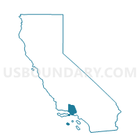
Outline

Summary
| Unique Area Identifier | 545874 |
| Name | Voting District OCEAN |
| County | Ventura County |
| State | California |
| Area (square miles) | 161.07 |
| Land Area (square miles) | 0.00 |
| Water Area (square miles) | 161.07 |
| % of Land Area | 0.00 |
| % of Water Area | 100.00 |
| Latitude of the Internal Point | 34.35484240 |
| Longtitude of the Internal Point | -119.44340200 |
Maps


Graphs
Select a template below for downloading or customizing gragh for Voting District OCEAN, Ventura County, California


Neighbors
Neighoring Voting District (by Name) Neighboring Voting District on the Map
- Voting District 10000, Ventura County, CA
- Voting District 10010, Ventura County, CA
- Voting District 10015, Ventura County, CA
- Voting District 10021, Santa Barbara County, CA
- Voting District 10065, Ventura County, CA
- Voting District 20500, Ventura County, CA
- Voting District 20515, Ventura County, CA
- Voting District 30535, Ventura County, CA
- Voting District 30540, Ventura County, CA
- Voting District 30545, Ventura County, CA
- Voting District 30550, Ventura County, CA
- Voting District 32607, Los Angeles County, CA
- Voting District 51180, Ventura County, CA
- Voting District 51255, Ventura County, CA
- Voting District 51256, Ventura County, CA
- Voting District OCEAN, Santa Barbara County, CA
- Voting District OCEAN, Los Angeles County, CA
Top 10 Neighboring County Subdivision (by Population) Neighboring County Subdivision on the Map
- Oxnard CCD, Ventura County, CA (234,919)
- Ventura CCD, Ventura County, CA (111,889)
- Agoura Hills-Malibu CCD, Los Angeles County, CA (63,824)
- Carpinteria CCD, Santa Barbara County, CA (17,718)
- Triunfo Pass-Point Mugu CCD, Ventura County, CA (1,930)
Top 10 Neighboring Place (by Population) Neighboring Place on the Map
- Oxnard city, CA (197,899)
- San Buenaventura (Ventura) city, CA (106,433)
- Port Hueneme city, CA (21,723)
- Channel Islands Beach CDP, CA (3,103)
Top 10 Neighboring Elementary School District (by Population) Neighboring Elementary School District on the Map
- Oxnard Elementary School District, CA (125,982)
- Hueneme Elementary School District, CA (56,154)
- Ocean View Elementary School District, CA (17,510)
Top 10 Neighboring Secondary School District (by Population) Neighboring Secondary School District on the Map
Top 10 Neighboring Unified School District (by Population) Neighboring Unified School District on the Map
- Ventura Unified School District, CA (118,441)
- Santa Monica-Malibu Unified School District, CA (108,886)
- Carpinteria Unified School District, CA (17,930)
Top 10 Neighboring State Legislative District Lower Chamber (by Population) Neighboring State Legislative District Lower Chamber on the Map
Top 10 Neighboring State Legislative District Upper Chamber (by Population) Neighboring State Legislative District Upper Chamber on the Map
Top 10 Neighboring 111th Congressional District (by Population) Neighboring 111th Congressional District on the Map
- Congressional District 23, CA (695,404)
- Congressional District 24, CA (681,622)
- Congressional District 30, CA (662,319)
Top 10 Neighboring Census Tract (by Population) Neighboring Census Tract on the Map
- Census Tract 44, Ventura County, CA (7,251)
- Census Tract 36.09, Ventura County, CA (5,966)
- Census Tract 29.05, Ventura County, CA (5,478)
- Census Tract 47.15, Ventura County, CA (5,020)
- Census Tract 25, Ventura County, CA (4,795)
- Census Tract 36.12, Ventura County, CA (4,355)
- Census Tract 8004.06, Los Angeles County, CA (2,644)
- Census Tract 24, Ventura County, CA (2,571)
- Census Tract 17.04, Santa Barbara County, CA (2,565)
- Census Tract 43.05, Ventura County, CA (2,388)
Top 10 Neighboring 5-Digit ZIP Code Tabulation Area (by Population) Neighboring 5-Digit ZIP Code Tabulation Area on the Map
- 93033, CA (82,728)
- 93036, CA (41,691)
- 93001, CA (32,990)
- 93035, CA (27,732)
- 93041, CA (23,641)
- 90265, CA (18,116)
- 93013, CA (16,091)